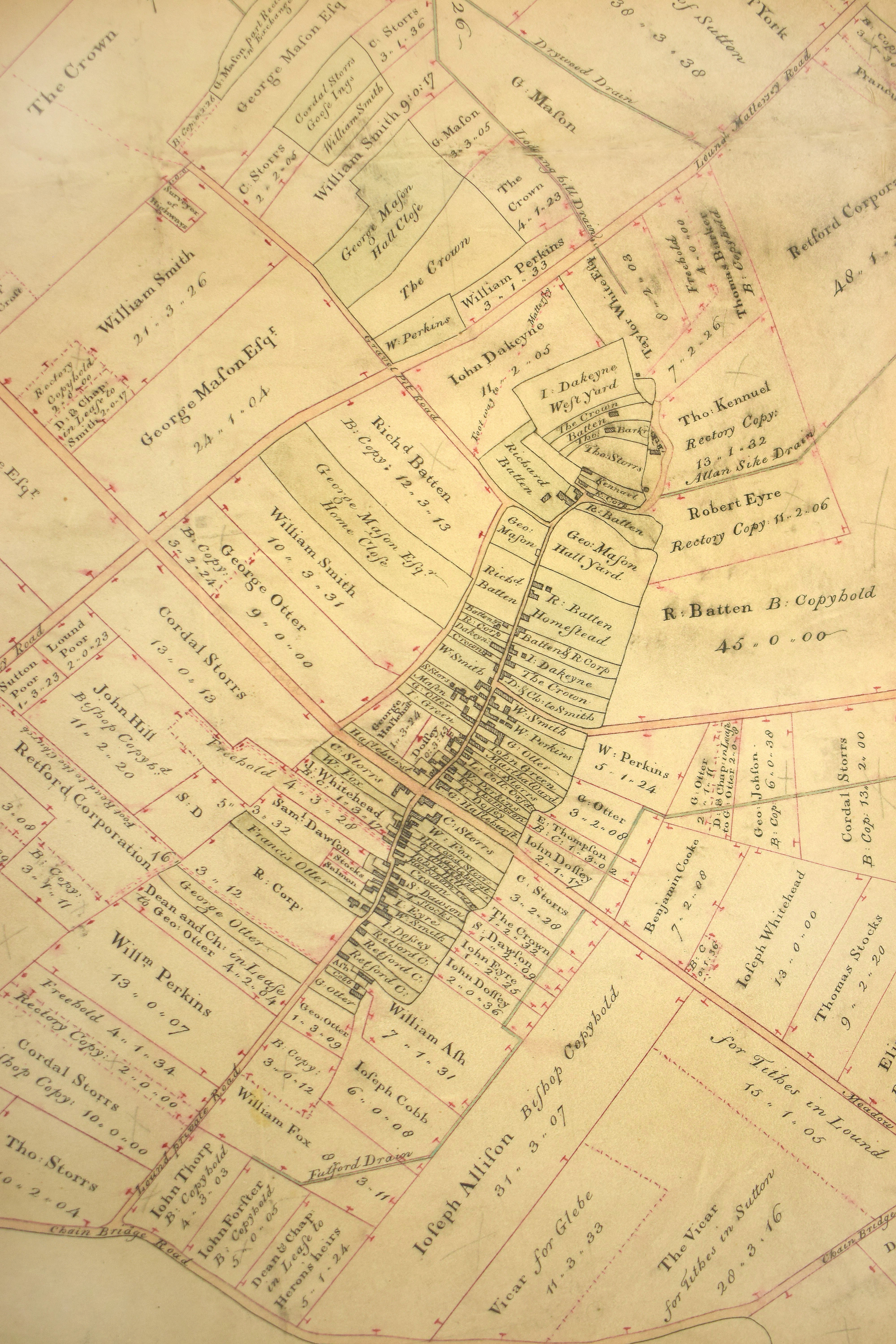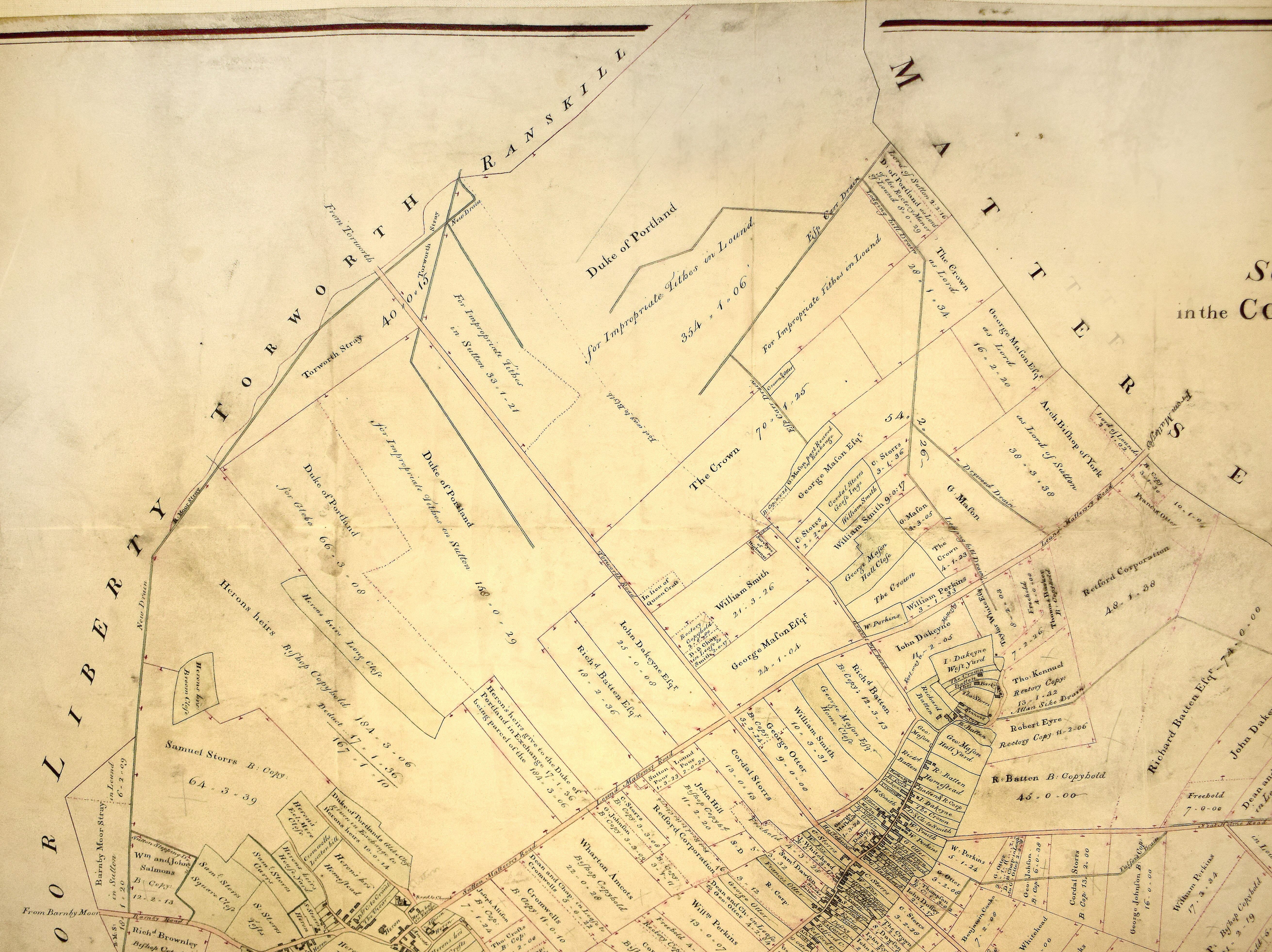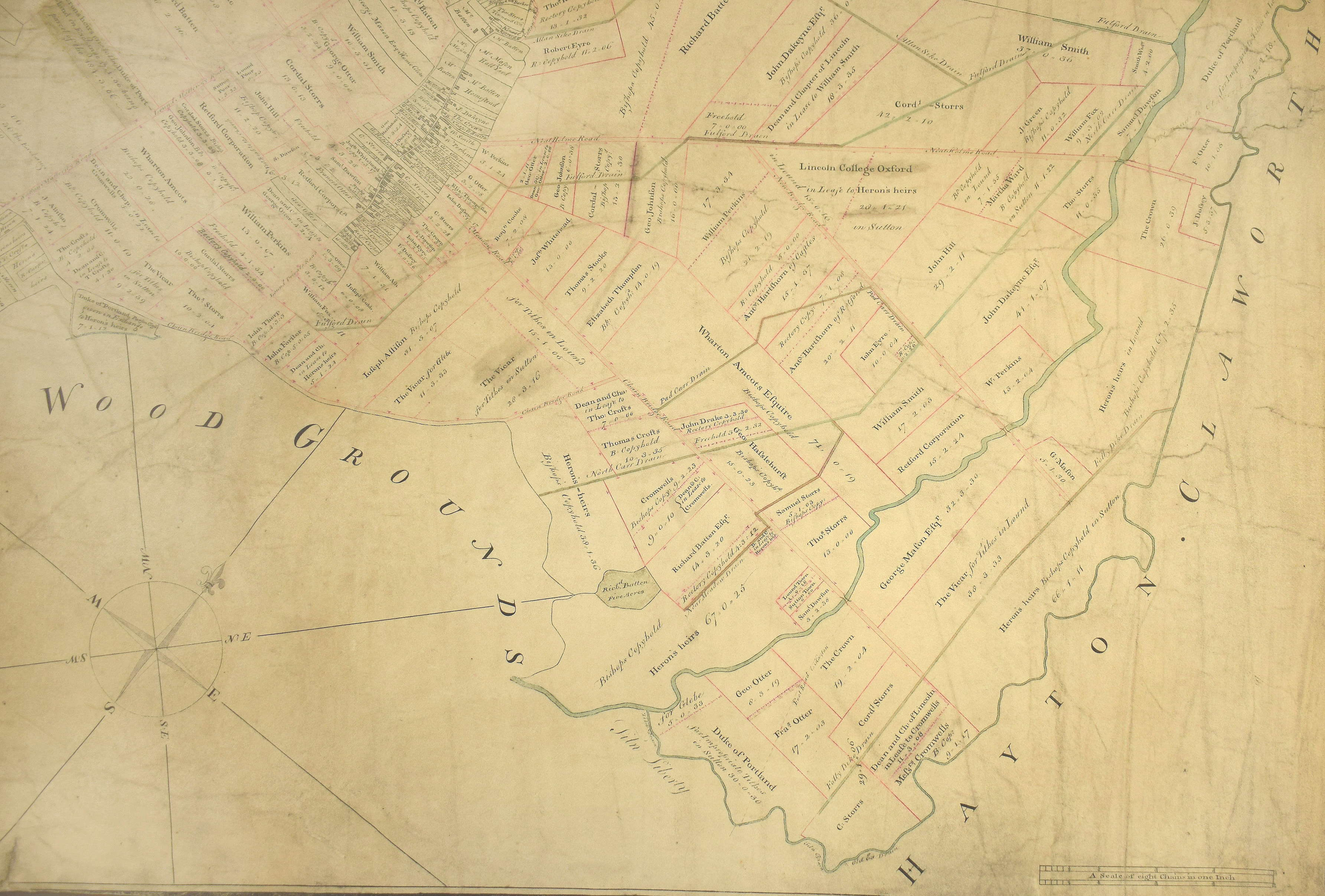
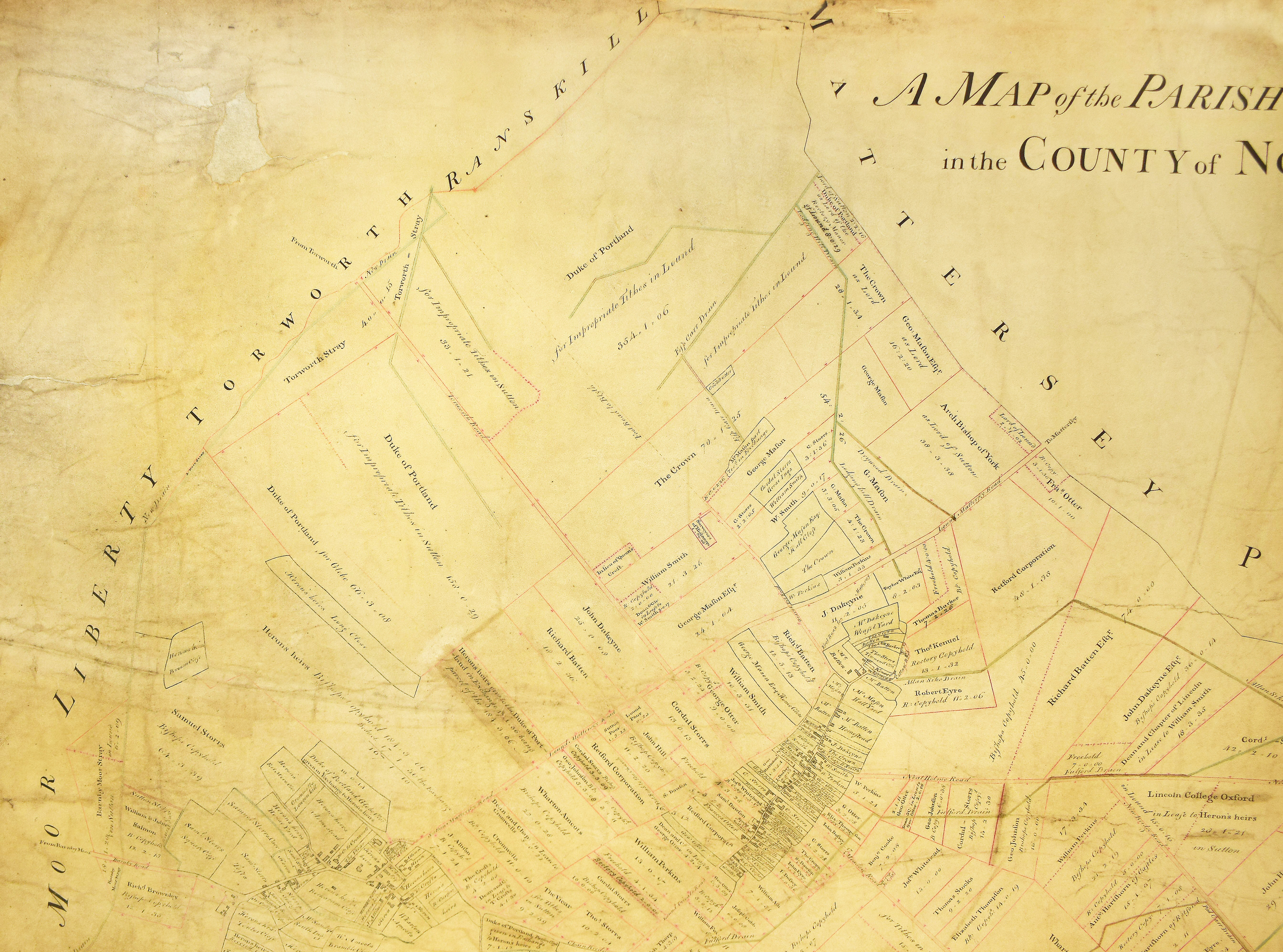
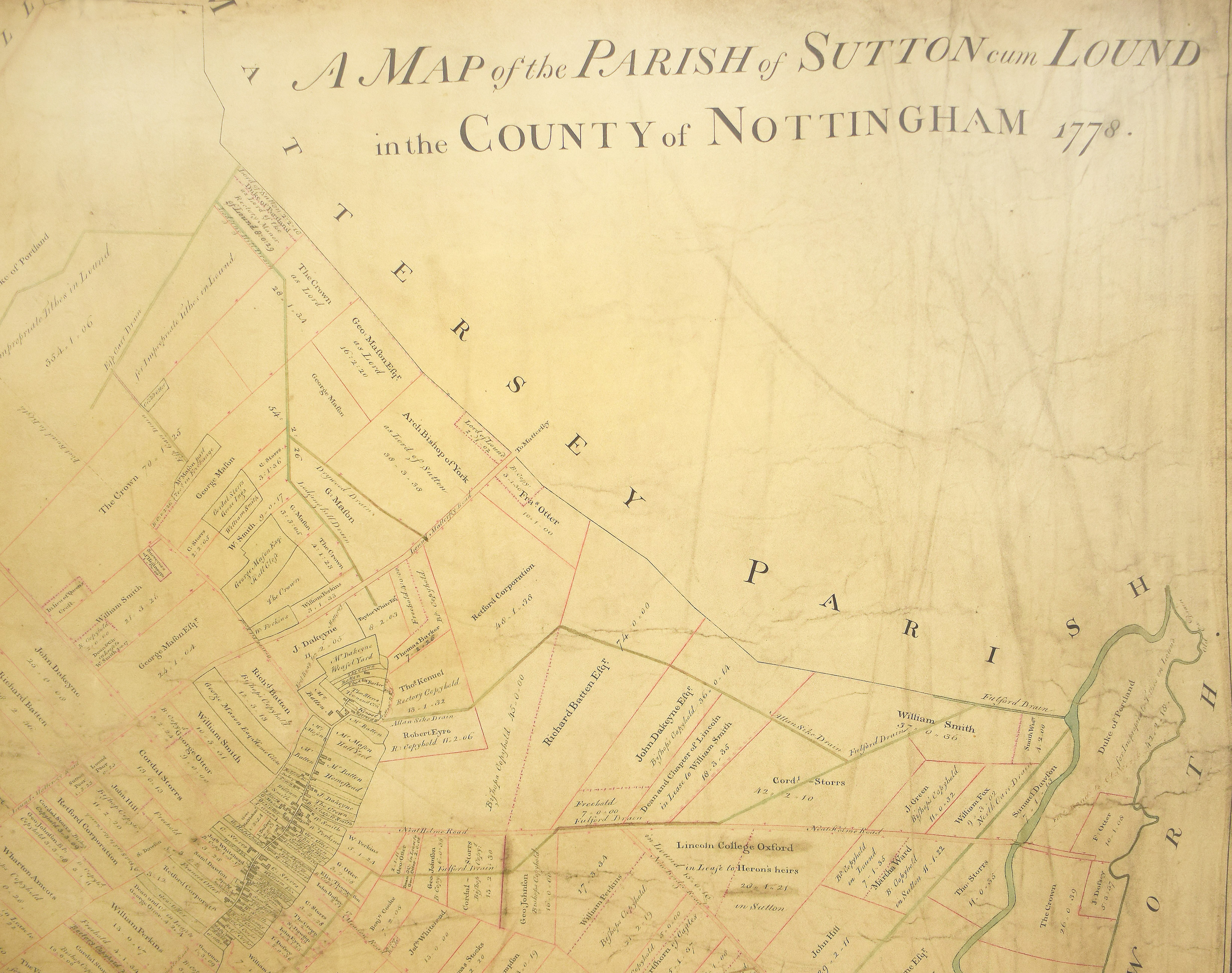
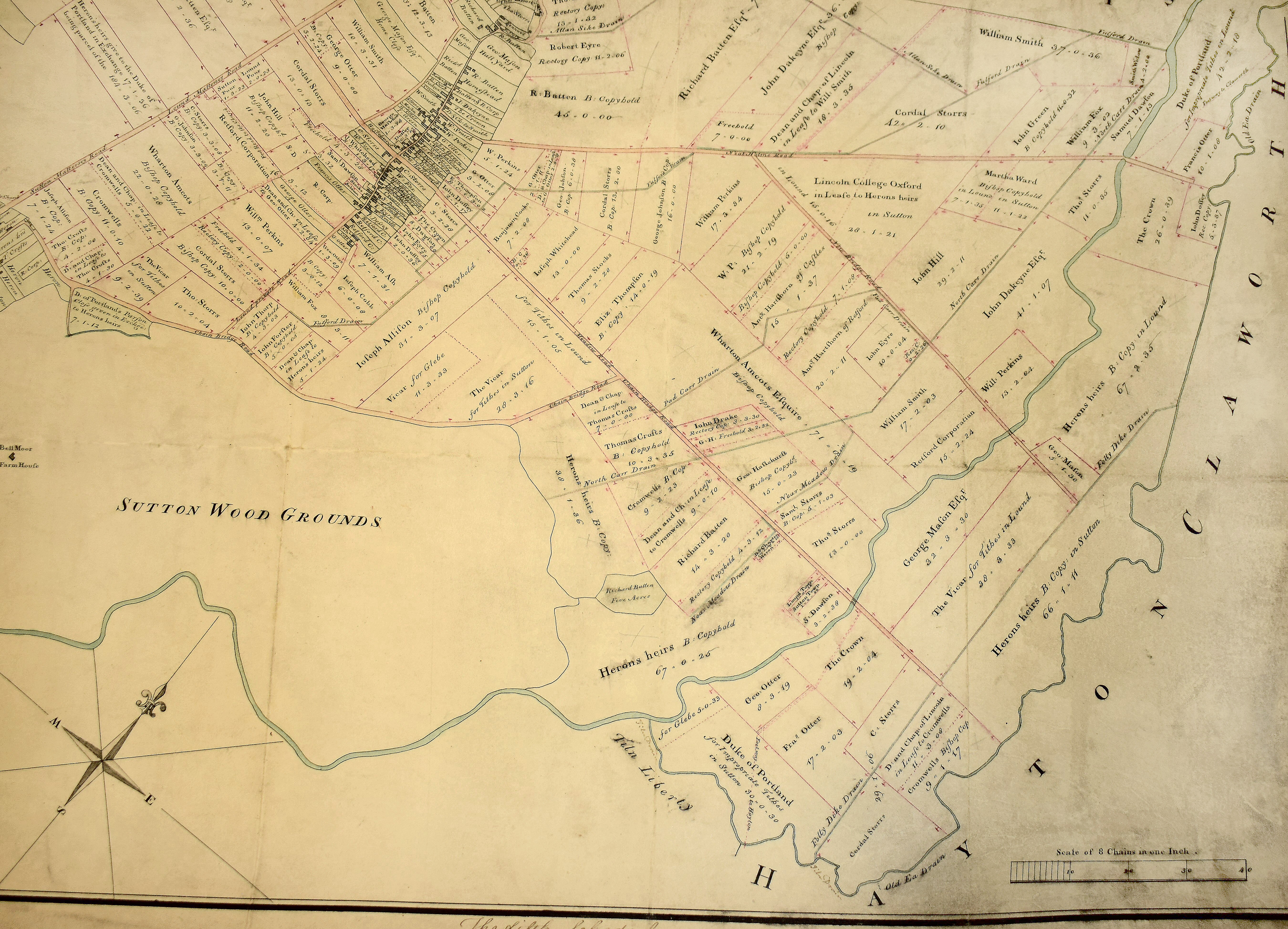
The village has obtained images of two original “Sutton cum Lound Enclosure Maps”, dated 1778, from Nottinghamshire Archives. These show how the large mediaeval open fields, with their multitude of individual long, thin strips, were “enclosed” to form more efficient fields as we see today. To do this an Act of Parliament was needed specifically for the Parish of Sutton cum Lound, long before two separate Civil Parishes were created for Sutton and Lound. At the time these maps were drawn by hand, King George III was on the throne and Great Britain was fighting the American War of Independence. The French Revolution and the Napoleonic Wars were still to come.
The maps, which are almost, but not quite, identical (look for Cottage Road), show an amazing amount of detail about our village 240 years ago. The owners of the new fields are shown, together with the areas in Acres, Roods and Perches. None of the large houses, including our listed buildings, or the school on Mattersey Road, or St Anne’s Church, or our three Chapels had yet been built. Most of the buildings that can be seen were probably still of wooden construction and many of them could have been shelters for animals. Despite this, there are many things which are instantly recognisable to the Lound resident of today, such as the layout of the roads and footpaths, despite different names and the familiar toft plots running at right angles to Town Street.
Acknowledgement: Inspire Nottinghamshire Archives reference numbers EA/80/1/2 and EA/80/1/4
Enclosure Maps
MAP – Ref Numbers EA/80/1/2 – (5 sections – ‘Click’ on individual maps to enlarge)


MAP – Ref Numbers EA/80/1/4 – (5 sections – ‘Click’ on individual maps to enlarge)